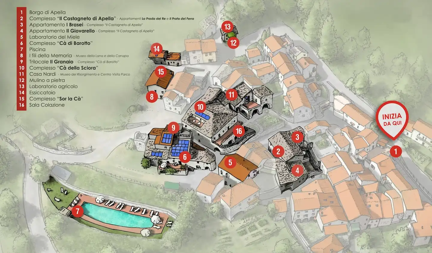
Map of Apella

The Apella map in words
The map shows the area between the village of Apella and Taponecco. The Tower of Apella houses the agriturismo headquarters, restaurant and Park Visitor Centre. The map also identifies Santa Maria Assunta church and “L’Abete Bianco” Biopark. Chestnut groves and olive groves surround the villages.
The red dotted route is the Trekking Lunigiana trail, connecting the Taponecco area, the Tower and Apella. From Apella, the map marks the TL trail towards Compione and CAI trail 114 towards Prada del Re and Capanne del Giovarello. Road arrows point towards Bagnone and Pontremoli in one direction and towards Tavernelle and Licciana Nardi in the other.
3D Tour